NASA via YouTube


What Peak Hurricane Season Looks Like From the Space Station
Get an astronaut’s view of not one but three major storms.
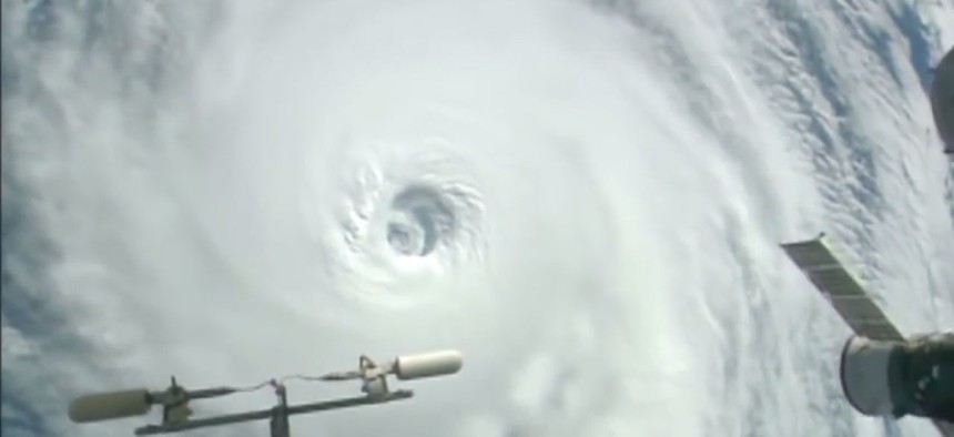
The Atlantic and Pacific are in their peak hurricane seasons , windows within the normal seasons with high chances of frequent, dangerous storms. And true to history, there’s great violence in the waters, as seen in these time-lapse shots from the International Space Station.
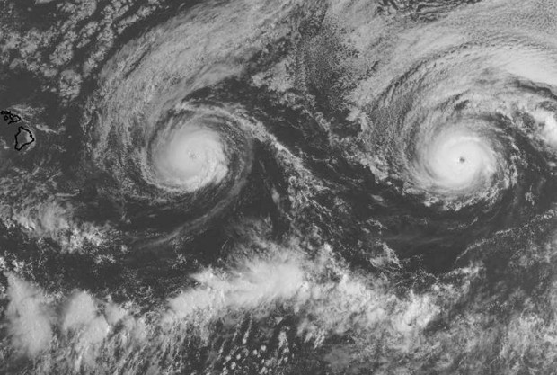
The footage first shows Hurricane Lester on its creep toward Hawaii. Lester rated a Category 4 on Tuesday night and is expected to brush the state to the north around the weekend. Then there’s Hurricane Madeline , also a Category 3 on Tuesday, which is predicted to hit or graze Hawaii to the south starting this evening.
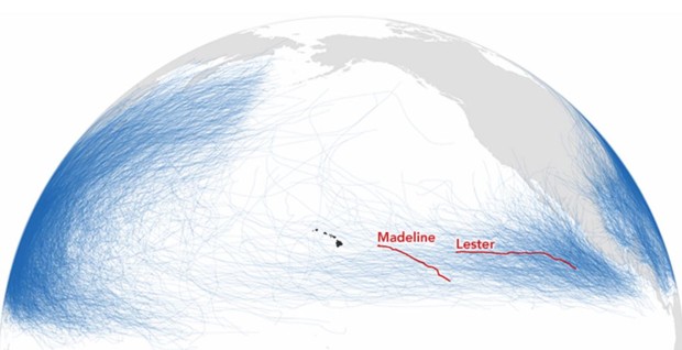
This one-two punch is rare, and if one of these storms were to directly cross Hawaii’s main island, it’d be historic. No “hurricane has made landfall on the Big Island since recordkeeping started in 1949,” writes NASA . "Only 13 hurricanes have passed within 200 nautical miles of the island in that time.” This graphic of storm tracks from 1842 to 2016 illustrates the unusual situation boiling in the Pacific:
Also notable, in a less-serious way, is that the storm clouds viewed from above resemble a cantankerous face:
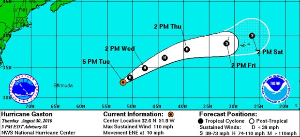
Finally there’s Hurricane Gaston , another Category 3, twirling eastward in the Atlantic. Gaston has been strengthening a bit as it moves toward the Azores but does not, despite what some publications luridly claim , pose any threat whatsoever to the Americas.